Mapping the Great Lakes, from Discovery to Scientific Survey
Date
Time
Location
Cost
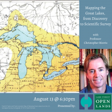
History Professor Christopher Morris of the University of Texas at Arlington will discuss what the cartographic history of the Great Lakes tells us about what map makers knew, hoped to know, and failed to learn about the lakes, from the early explorations of Samuel de Champlain to the modern era of the British Admiralty, the U.S. Army Corps of Topographical Engineers, and their hydrological surveys. Morris will also discuss what the maps do and do not reveal about climate change over the last 400 years, and offer some thoughts about the relationship between scientific and humanistic evidence of the history of the Great Lakes.
About the speaker:
Professor Morris is the author of two books, Becoming Southern: The Evolution of a Way of Life, Warren County and Vicksburg, Mississippi, 1770-1860, and The Big Muddy: An Environmental History of the Mississippi and Its Peoples from Hernando de Soto to Hurricane Katrina. In addition, he has authored more than a dozen articles, essays, and book chapters, and co-edited three essay collections, on subjects ranging from slavery in the sugarcane fields of Louisiana to climate change as revealed in the cartographic history of the Great Lakes. He is best known for his work on the relationship between people and the natural environment in the American South, although his work has taken him around the world. For example, he has written on comparative river delta environments in North America, Senegal, India, and China.
This program is co-presented with Lake Forest Open Lands

Image Credit: https://bit.ly/3gBVaWW